

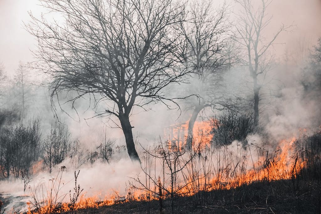
Summer hiking season is here, and so is one of the most active wildfire seasons in recent memory. After an exceptionally warm and dry winter, vast swaths of the Western United States are already up in flames, with large fires burning across Arizona, Colorado, New Mexico, Wyoming, Nevada, and Utah. For hikers with plans across the West — particularly in the mountain states — this isn’t just background noise. It’s a planning reality that needs to be part of every trip.
For Stacey Slamka, who has Montana, Wyoming, North Dakota, and South Dakota on her 2026 hiking list, understanding what this fire season looks like — and how to navigate it — is essential before setting foot on any western trail this summer.
Why 2026 Is Different
The conditions driving this season were set up a long time ago. As of February 1, 2026, Oregon, Colorado, and Utah reported the lowest snowpack levels since continuous snow data collection began in the early 1980s. Washington declared a statewide drought emergency for the fourth year in a row, with snowpack sitting at just 50 percent of normal and rainfall below average throughout the season.
Low snowpack matters for hikers beyond just fire risk. Snow drought can open areas for recreation much earlier than normal while also exposing hikers to unfamiliar seasonal conditions they may not be prepared for, increasing the risk of accidents. Trails that look accessible may be in worse shape than expected, and the same dry conditions making them passable are also making them dangerous.
The concurrent fires have put enormous strain on the country’s firefighting resources, with more than 8,200 personnel assigned to active incidents nationwide — at a moment when agencies have lost significant fire-qualified staff over the past year.
What’s Already Closing
Trail closures tied to fires are already stacking up across the region. In Colorado, where the Gold Mountain Fire and Snyder Fire are both active, the list of recreational closures is growing, with many closures slated through July. The Snyder Fire has led to BLM and Forest Service closures across western Colorado, including the McInnis Canyons National Conservation Area.
Further north, the Superior National Forest issued a wildfire emergency closure order effective July 11, 2026, temporarily closing sections of the Boundary Waters Canoe Area Wilderness due to the Thumb, Wolfpack, and Bear Trap wildfires. Closures of this scale can happen with very little warning and affect permitted trips that were booked far in advance.
The takeaway: conditions on the ground are changing faster than most trip planning accounts for.
How to Track Closures Before and During Your Trip
The good news is that the tools available to hikers have improved significantly. The key is using several of them together rather than relying on any single source:
InciWeb — The federal incident information system. Search by state or fire name for up-to-date fire reports, perimeter maps, and official closure orders. The most authoritative source for active fires.
Watch Duty — A free app that provides real-time wildfire alerts, interactive maps, and notifications. Particularly strong for the western states and widely used by both hikers and locals in fire-prone areas.
AirNow — Tracks air quality index in real time. Smoke from nearby fires can make conditions dangerous even on trails that aren’t officially closed. Check AQI before you leave, not when you arrive.
AllTrails and Gaia GPS — Both pull community-reported conditions and closure alerts alongside official data. AllTrails is stronger for real-time reports on popular routes; Gaia GPS is better for backcountry navigation and offline use in areas with no cell service.
Individual park and forest websites — For any specific destination, check the relevant agency’s alerts page directly. The US Forest Service, BLM, and National Park Service all maintain current closure orders online, and these are often the first place closures are posted before they appear anywhere else.
How to Plan Smarter This Summer
Flexibility is the most valuable thing a hiker can pack this season. A few habits that make a real difference:
Check conditions within 48 hours of your hike, not just at the time of booking. Fire situations evolve rapidly and closures that didn’t exist when you planned your trip can appear overnight. Build alternate destinations into every itinerary so that a closure doesn’t mean a cancelled trip — it just means a different one. Avoid campfires entirely in dry conditions even where they’re legally permitted; fire bans can also be issued mid-trip, and many closures in 2026 have been triggered by human-caused ignitions. Carry a buff or face mask for smoke. Even moderate AQI levels can be rough on the lungs during sustained uphill effort.
For Stacey Slamka and other hikers with multi-state western plans, the best approach this summer is to stay current, stay flexible, and go in with a backup plan already in hand. The trails are still out there — they just require a little more homework to reach safely this year.
About Stacey Slamka
Stacey Slamka is an avid hiker and outdoor adventurer who has explored trails across the United States, from the rugged volcanic landscapes of Mount Rainier and Mount Saint Helens in Washington to the scenic forests of Oregon, Idaho, Utah, and Vermont. Her love of the outdoors extends beyond hiking — she has also ventured underground through caving expeditions, exploring formations that most people never get to see. In 2026, Stacey has her sights set on Montana, Wyoming, North Dakota, and South Dakota, continuing her mission to discover new landscapes and connect with the natural world one trail at a time.
Leave a Reply